KRUM (2023) - wintering - subadult male from Makov Rescue Station

Post Reply
marika.solo
Site Admin
Posts: 23363
Joined: 29 Sep 2021, 09:38

Re: KRUM (2023) - wintering - subadult male from Makov Rescue Station

Post by marika.solo »

previous data 17.02 viewtopic.php?p=53553#p53553 - next data 19.02 viewtopic.php?p=53568#p53568

February 18
Hello everyone :-)

CHIRPAN AREA - infos, photos viewtopic.php?p=53445#p53445

NIGHT (17.02/18.02) - Starata River Valley (not far from Derjava - south from Gita)
- Bulgaria: Da/erjava (Държава) - a village in Chirpan Municipality of Stara Zagora Province

DAY (18.02) - along the Starata River ad the nearby fields
- Bulgaria: Bulgaria: Gita (Гита) - a village in Chirpan Municipality of Stara Zagora Province

weather / počasie (click)
Image
https://www.meteobalkans.com/evropa/bulgaria/darjava

today in the country: https://static.meteobalkans.com/images/ ... titled.png
marika.solo
Site Admin
Posts: 23363
Joined: 29 Sep 2021, 09:38

Re: KRUM (2023) - wintering - subadult male from Makov Rescue Station

Post by marika.solo »

Last position: 2026-02-18 10:00:15 (UTC)

zoomed view on his spot (02/2012) https://maps.app.goo.gl/F1mNSyzUokbhjG4i8

Image

Image
marika.solo
Site Admin
Posts: 23363
Joined: 29 Sep 2021, 09:38

Re: KRUM (2023) - wintering - subadult male from Makov Rescue Station

Post by marika.solo »

Last position: 2026-02-18 15:50:28 (UTC)

still there - along the Starata River / stále tam - okolo rieky Starata

Image

the same area years ago - google earth view 24.02.2017
Image
marika.solo
Site Admin
Posts: 23363
Joined: 29 Sep 2021, 09:38

Re: KRUM (2023) - wintering - subadult male from Makov Rescue Station

Post by marika.solo »

- Krum moved 800 m south for the night to the confluence of the Starata River and a small stream.
- Krum sa na noc presunul o 800 m južnejšie k sútoku rieky Starata a malého potôčku.

Image
marika.solo
Site Admin
Posts: 23363
Joined: 29 Sep 2021, 09:38

Re: KRUM (2023) - wintering - subadult male from Makov Rescue Station

Post by marika.solo »

whole day 18.02.2026

Image
marika.solo
Site Admin
Posts: 23363
Joined: 29 Sep 2021, 09:38

Re: KRUM (2023) - wintering - subadult male from Makov Rescue Station

Post by marika.solo »

previous data 18.02 viewtopic.php?p=53560#p53560 - next data 20.02

February 19
Hello everyone :-)

CHIRPAN AREA - infos, photos viewtopic.php?p=53445#p53445

NIGHT (18.02/19.02) - Starata River Valley (not far from Derjava - SW from Gita)
- Bulgaria: Gita (Гита) - a village in Chirpan Municipality of Stara Zagora Province

DAY (19.02)
- Bulgaria:

weather / počasie (click)
Image
https://www.meteobalkans.com/evropa/bulgaria/darjava
marika.solo
Site Admin
Posts: 23363
Joined: 29 Sep 2021, 09:38

Re: KRUM (2023) - wintering - subadult male from Makov Rescue Station

Post by marika.solo »

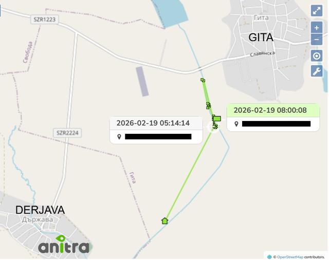
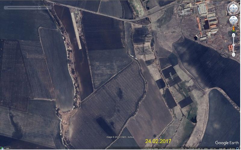
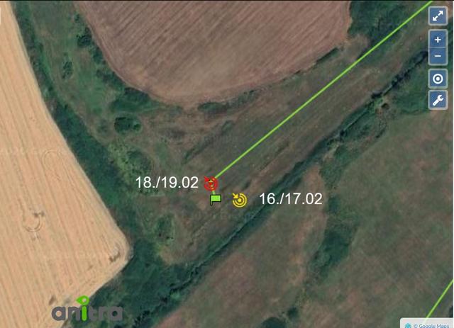
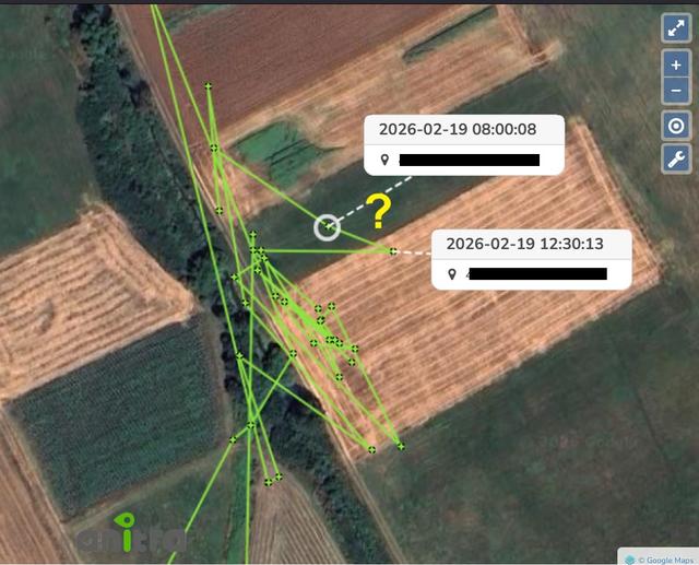
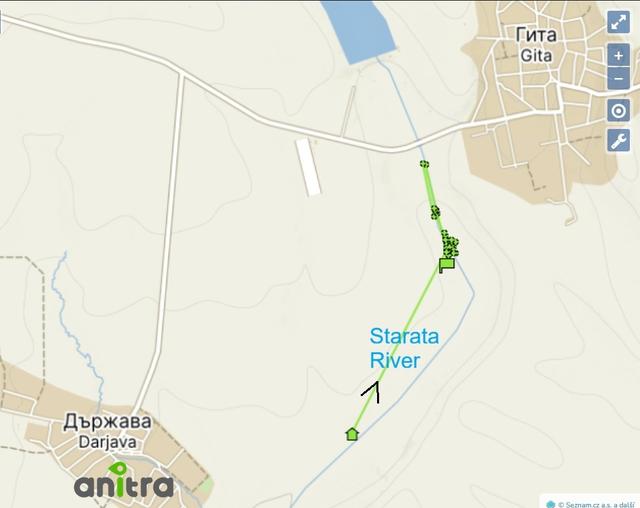
transmission at 10:02 - 
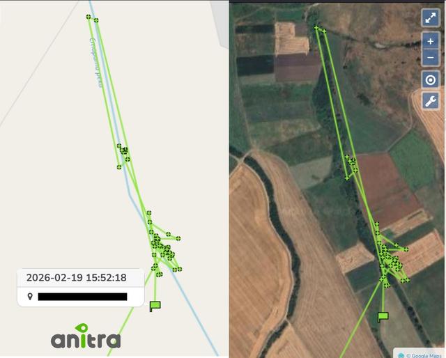
Last position: 2026-02-19 08:00:08 (UTC)
the battery level dropped to 28% (and the temperature increased to 41°C)

Krum flew that time - speed 9,0 km/h : Grnd Speed km/h (GNSS)

Ground/Grnd speed is the horizontal component of the velocity of an aircraft relative to the Earth’s surface, also referred to as "speed over the ground".

Global Navigation Satellite System (GNSS)
Very often, “GPS” (Global Positioning System) is used instead of the abbreviation “GNSS”. However, this is only partially correct if we are talking about all constellations because GPS is one of the GNSS constellations that was put into operation by the United States.
As of 2024, the following constellations are functioning: GPS (United States’s Global Positioning System), GLONASS (Russia’s Global Navigation Satellite System), BDS (China’s BeiDou Navigation Satellite System) and Galileo (European Union’s Satellite System)

GPS:
Orbit: Medium Earth Orbit (MEO).
Altitude: About 20200 km.
Number of satellites: 31 (with reserved satellites).
Orbital planes: 6, with an inclination of about 55 degrees to the equator.
Satellite rotation time is about 12 hours.
The accuracy of standard GNSS receivers without additional correction and improvements is 5-10 meters in the horizontal plane. Various methods and technologies are used to minimize errors and improve location data to improve the accuracy of GNSS positioning.

Image
marika.solo
Site Admin
Posts: 23363
Joined: 29 Sep 2021, 09:38

Re: KRUM (2023) - wintering - subadult male from Makov Rescue Station

Post by marika.solo »

NO data from 08:00:00 (battery: 24%) to 12:30:13 (battery: 96%)

Image

Last position: 2026-02-19 15:52:18 (UTC)

Image

Image
Post Reply

Return to “Czechia”