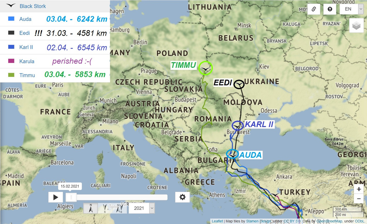
BIRDMAP OVERVIEW 28.03.2022 - evening update
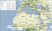
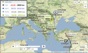
KARL II viewtopic.php?p=1349#p1349 and next (by Madli)
- Last data: 28.03.2022, Distance: 6021km
- Motoșeni (formerly Ursa Motoșeni) is a commune in Bacău County, Western Moldavia, ROMANIA
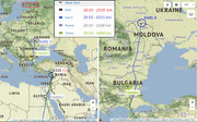
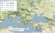
TIMMU viewtopic.php?p=1330#p1330 and next (by Madli)
- Last data: 28.03.2022, Distance: 4281 km
- west from Esetçe - a belde in İpsala district of Edirne Province, TURKEY - on the Balkans in Southeast Europe
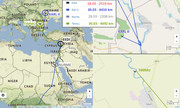
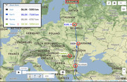
EEDI viewtopic.php?p=1272#p1272 and next
NO new data
- Last data: 18.03.2022, distance: 2519 km
- Maradash (Mirdash) - a SYRIAn village located in Shathah Subdistrict in Al-Suqaylabiyah District, Hama Governorate
EEDI ... last data come through SMS in Turkey, near Adana. Can't say anything more by now (by Urmas)
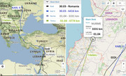
NURME viewtopic.php?p=1333#p1333 and next
- Last data: 28.03.2022
- west from Luxor, Qena Governorate, EGYPT


