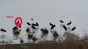
MARE https://goris.lv/mare-2017/
March 29
Hello everyone
 previous data
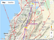
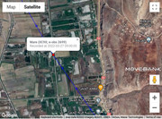
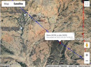
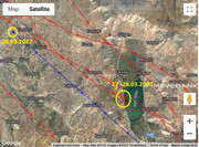
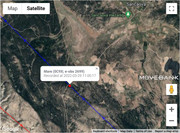
- 28.03.2022, 93 424 km, app: 603,7 km (24h)

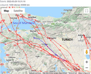
- on the fields south from Tuzlukçu - a town and district of Konya Province in the Central Anatolia region of TURKEY (maybe on the way to Lake Akşehir)
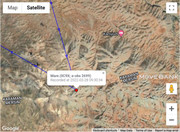
new data
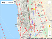
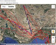
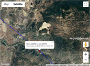
- 29.03.2022, 93 696 km,
app: 190,8 km (24h)
- south from Kabaklar, Orhaneli district of Bursa province, TURKEY (on the slope - Orhaneli Stream flow in the valley - there is the confluence of Keles Creek)
basic informations:
viewtopic.php?p=1209#p1209
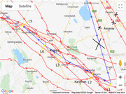
usually localisations are: L1 at 8.40, L2 at 10h, L3 at 11.30, L4 at 13h and L5 at 14.30
click for big pic
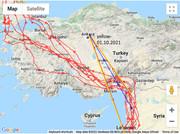
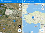
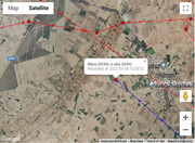
maps:
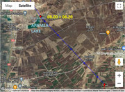
1/ situation - 2/ today path line - 3/there is street view


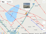
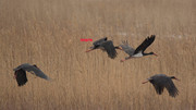
STREET VIEW on her localisation (the red symbol - loc. L5 at 14.30)
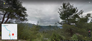 https://goo.gl/maps/QCi6j4Pi2wCAcvxP9
 image capture May 2019