November 16
Hello everyone

Birdmap update for
WABA https://birdmap.5dvision.ee/EN/2022/aut ... =0&speed=1
Previous data:
viewtopic.php?p=10936#p10936
- 15.11.2022, Distance: 7462 km (
+ 11 km)
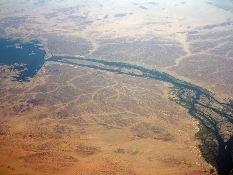
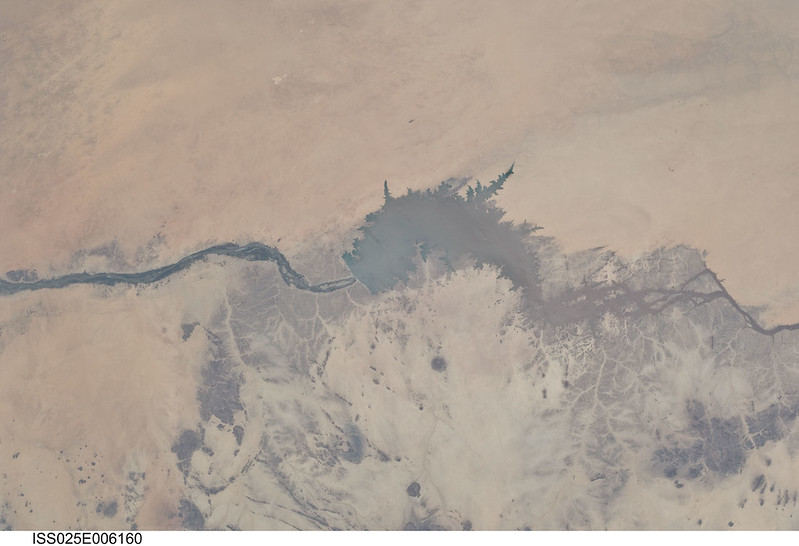
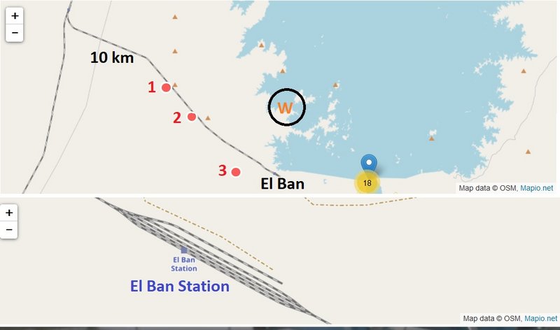
- SUDAN: Karima - Northern State
NEW data: (update 16.11.in the midday)
- 15.11.2022, Distance: 7510 km (
+ 48 km)
- SUDAN: Karima - Northern State
names: Kareima, Karemah, Karima, Karêmah, Kuraymah - on the google map we see Kuraymah Barkal
on the opposite site is Nuri
Waba stayed in the same area. Waba flew north, made a trip to Merowe Reservoir and returned.


