March 31
Hello everyone
previous data
- 29.03.2022, 93 696 km, app: 190,8 km (24h)
- south from Kabaklar, Orhaneli district of Bursa province, TURKEY (on the slope - Orhaneli Stream flow in the valley - there is the confluence of Keles Creek)
new data
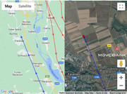
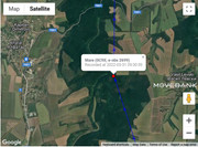
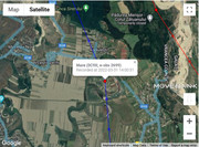
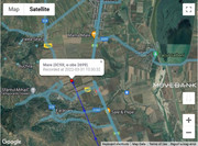
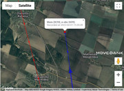
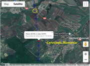
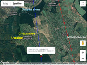
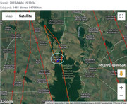
- 31.03.2022, 94 451 km, app: 286,2 km (24h)
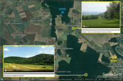
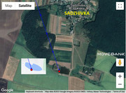
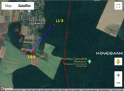
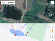
- north from Faraoani village in Bacău County, Western Moldavia, ROMANIA; on the fields near one irrigation canal (maybe)
basic informations: viewtopic.php?p=1209#p1209
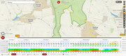
usually localisations are: L1 at 8.40, L2 at 10h, L3 at 11.30, L4 at 13h and L5 at 14.30
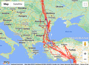
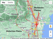
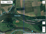
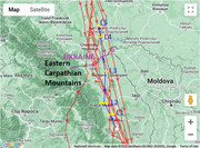
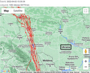
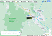
MARE today crossed Danube to the east from Silistra and continued to the NW above the Wallachian Plane and Moldavian Plateu. The last section she flew parallel with the river Siret (to the east) and the Eastern Carpathians (to the west)
click for big pic
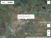
maps:
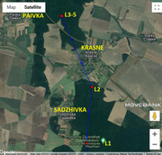
1/ situation - 2/ today path line - 3/ loc. L5


