Re: Discussion about migration

marika.solo
Site Admin
Posts: 15180
Joined: 29 Sep 2021, 09:38

Re: Discussion about migration

Post by marika.solo »

LV - MARE - TEFF

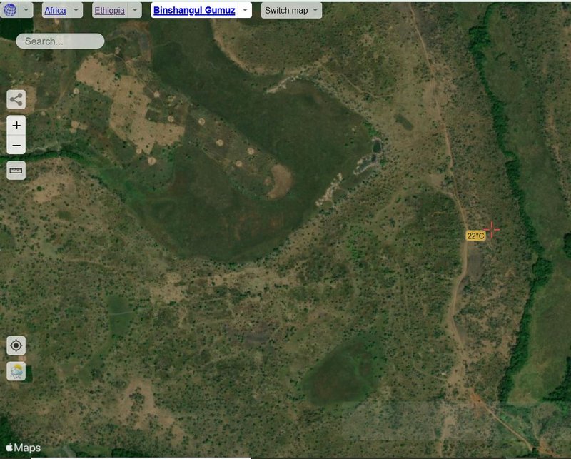
The light spots on the map are most probably places where teff - local cereal is being threshed. (Teff/Eragrostis tef, also known as dwarf millet, is to Ethiopia what maize is to Mexico and rice is to China: the country's most important foodstuf.)
- zoomed view on this place https://satellites.pro/Ethiopia_map#9.6 ... .714099,18

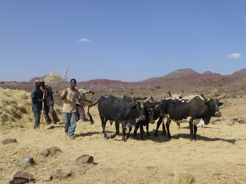
Teff threshed by using animals walking on the harvest
Image
By Ji-Elle - Own work, CC BY-SA 3.0, https://commons.wikimedia.org/w/index.p ... d=31146097

The harvest season traditionally lasts from the beginning of October to the end of January, depending on the region, rainfall, altitude, and other local features. The average growing season of teff is 17 weeks.
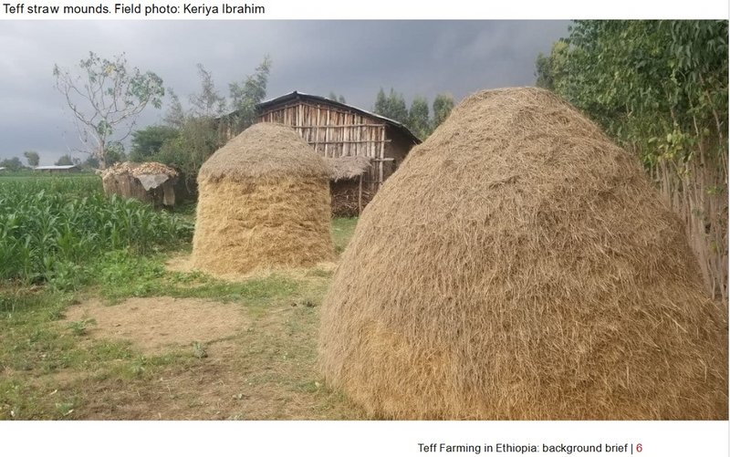
Teff dries for an average of 40 days between harvesting and threshing. Traditionally, farmers prepare the threshing area by coating it with a layer of cattle dung. Once the teff has been brought to the area, the teff is threshed by oxen trampling the teff. Further separation of seeds and cleaning is done by hand with traditional tools.

Image

(source: Teff farming in Ethiopia: a literature review. Background brief/2021. Full text PDF https://4det8y3z1n391t76me8rfynx-wpengi ... ief-vf.pdf)

short VIDEO
1/ Ethiopian Manual Teff Harvest with Sickles and Bullocks (traditional) https://youtu.be/e7HgtReLlvo
2/ modern harvest https://youtu.be/6syTkQXE7P4
marika.solo
Site Admin
Posts: 15180
Joined: 29 Sep 2021, 09:38

Re: Discussion about migration

Post by marika.solo »

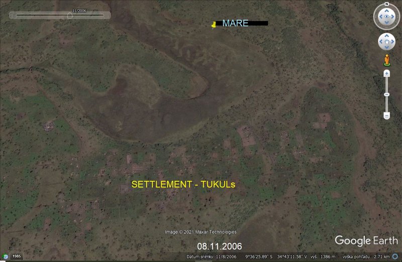
LV - MARE - TUKUL

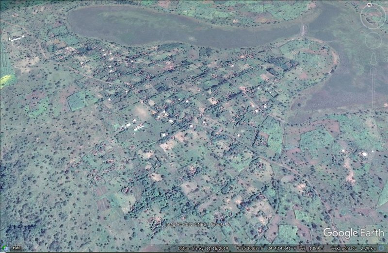
Mare flew also on January 25 - the line connecting her two localisations - above one populated place

(movebank map)
Image

that area without Mare's lines (3D)
Image

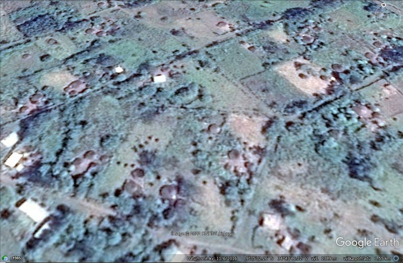
zoomed (3D) view - probably there are also the traditional houses - tukuls
Image
marika.solo
Site Admin
Posts: 15180
Joined: 29 Sep 2021, 09:38

Re: Discussion about migration

Post by marika.solo »

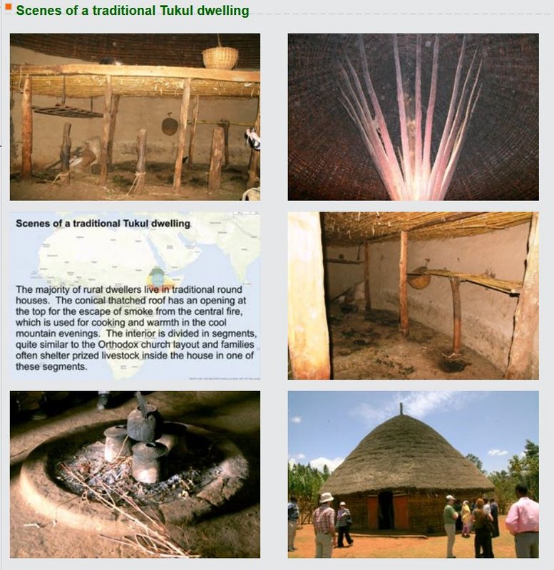
LV - MARE - TUKUL - continuation

Image
https://www.ajol.info/index.php/ejhd/article/view/9798
Abera K., Yemane B. (2002). Crowding in a traditional rural housing ("Tukul") in Ethiopia Ethiop.J.Health Dev. 16(3),303-308. DOI: 10.4314/ejhd.v16i3.9798

Image
http://ethiopianproject.southdublin.ie/ ... Itemid=109
marika.solo
Site Admin
Posts: 15180
Joined: 29 Sep 2021, 09:38

Re: Discussion about migration

Post by marika.solo »

LV - MARE - TUKUL - continuation

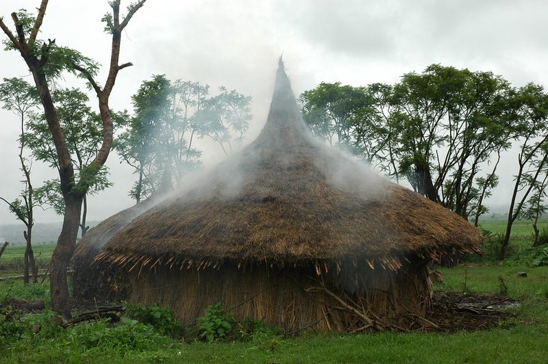
'Smoking' Ethiopian 'tukul'
A 'tukul,' the traditional round hut of rural Ethiopia, 'smokes' as breakfast is cooked inside in the rural highlands
(photo credit: ILRI/Apollo Habtamu)
.

Image
Taken on July 18, 2005 https://flic.kr/p/9p3yT7

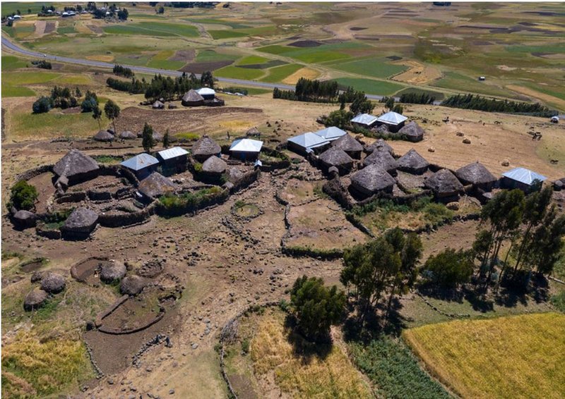
Village with tukuls in the highlands, Oromia, Sheno, Ethiopia
© Eric Lafforgue

Image
Taken on October 28, 2018 https://flic.kr/p/QY5FxY
marika.solo
Site Admin
Posts: 15180
Joined: 29 Sep 2021, 09:38

Re: Discussion about migration

Post by marika.solo »

TIMMU - EE
Madli wrote: 24 Jan 2022, 19:44 January 24
Hello everyone.

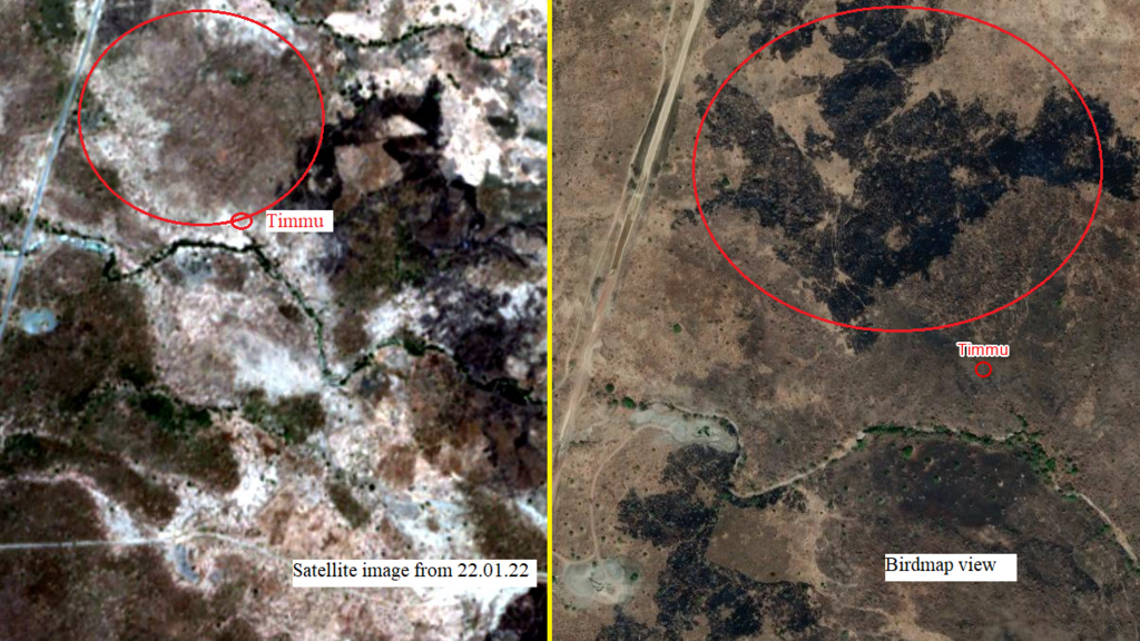
After some quick research I have made some discoveries from different sources about the burned land seen from the map in Timmu's area.

As we see from this image, the area where Timmu is today is different than the same area shown on the birdmap. The burned area has moved.
Image
Satellite image from EOS Land Viewer: https://eos.com/find-satellite/

About the land using pattern in Metema district:

The majority of the households (82.9%) are farmers and practised crop and livestock mixed farming system. According to the respondents, about 91.4% of the land is used for annual crop production; while 0.8% is covered by perennial crops, 3.1% is left for private grazing and 4.7% fallowed (edit 1: Fallow- a farming technique in which arable land is left without sowing for one or more vegetative cycles). This fallow land was associated with the widely practised shifting cultivation (edit 2: Shifting cultivation is an agricultural system in which a person uses a piece of land, only to abandon or alter the initial use a short time later) in the area as a means of soil fertility improvement measure. Based on the group discussion held with elders, some 10 years back, fallowing of farmland was practised for about 5–8 years and was a common practice in the district. The trend has been decreasing, and currently, land is left for fallow for about 2 to 4 years due to the increase in human population and the use of extensive areas for private investment.
Edit 1: Fallow https://en.wikipedia.org/wiki/Fallow
Edit 2: Shifting cultivation https://www.sciencedaily.com/terms/shif ... vation.htm
Source: https://cgspace.cgiar.org/handle/10568/3032
marika.solo
Site Admin
Posts: 15180
Joined: 29 Sep 2021, 09:38

Re: Discussion about migration

Post by marika.solo »

Madli wrote: 24 Jan 2022, 19:57 Continuation

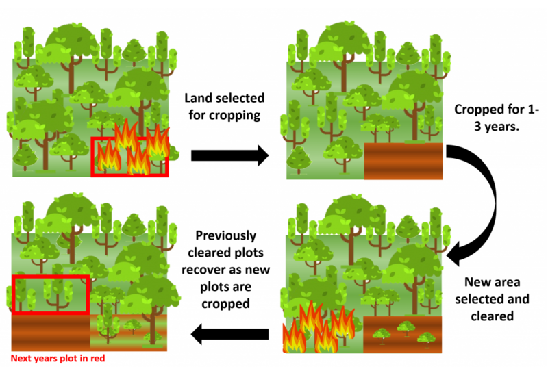
Shifting cultivation:
Image
http://grantham.sheffield.ac.uk/forest-restoration-cultivation/

Other possible reasons of land burning (citations from texts)

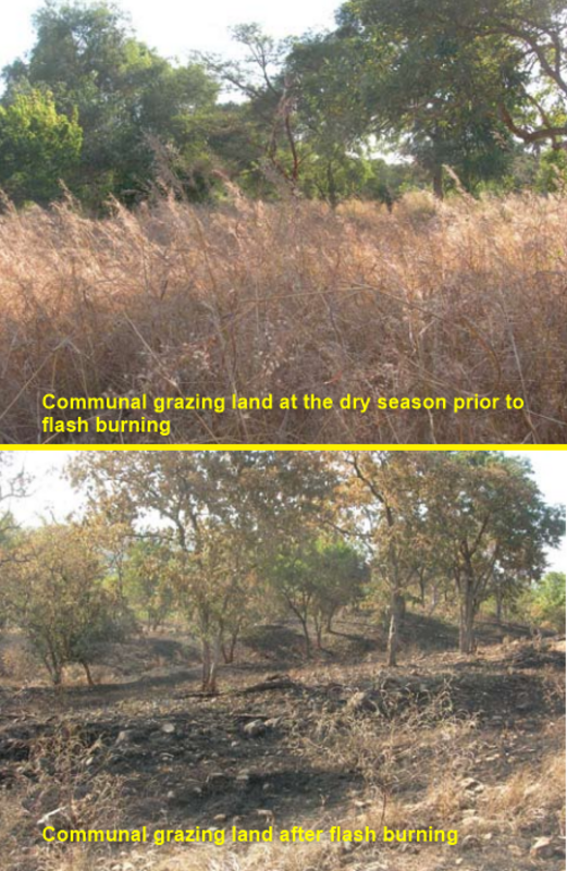
Livestock resources and production system- [...] In general, there is low feed resources conservation and utilization and very poor traditional grazing land management system in Metema. The abundant feed resources in the wet season are wasted. In the dry season, grasses are turned to ash by wild and man-made fire in the process of forest honey harvesting and crop land cleaning. As a result, the livestock populations seriously suffer from the critical feed shortage during the long dry season.
Source: https://cgspace.cgiar.org/bitstream/han ... sequence=4

Livestock are important sources of both power and cash for the smallholder farmers.[...] Despite the large population of livestock, especially cattle and goats, productivity is low as in many other parts of Ethiopia. [...] Experts believe that livestock feed is not a limiting resource in the woreda. However, the farmers in the woreda do not exercise hay making and dry season feed will remain to be a problem. This is especially so because farmers burn grasses for eliminating ticks and initiating new grass growth during the rainy season.
Source: Desalew T., Tegegne A., Nigatu, L. and Teka W. 2010. Rangeland condition and feed resources in Metema district, North Gondar Zone, Amhara Region, Ethiopia. IPMS (Improving Productivity and Market Success) of Ethiopian Farmers Project Working Paper 25. pp 90. Nairobi, Kenya, ILRI https://cgspace.cgiar.org/handle/10568/3032

Image
https://cgspace.cgiar.org/bitstream/handle/10568/3032/WorkingPaper_25.pdf?sequence=1&isAllowed=y
marika.solo
Site Admin
Posts: 15180
Joined: 29 Sep 2021, 09:38

Re: Discussion about migration

Post by marika.solo »

MARE - LV
the area is changing - there can be more reasons (I will add some of them from papers)

current google maps (16.11.2019): no sign of human presence
(Mare's localisation on 01.02 at 14.30, Mare has the location in the inner arch of the wetland this morning)
Image

google earth:
1/ 6.3.2012: it seems there were fires in a large area for some reason
2/ 20.4.2013: only small changes are noticeable
3/ 22.2.2014: pic is very very green
3/ 6.11.2016: overgrown fields seen in the image

mapbox: white areas where teff is threshed and still seen in the picture line of settlements to the south under the arch of the wetland
Image
marika.solo
Site Admin
Posts: 15180
Joined: 29 Sep 2021, 09:38

Re: Discussion about migration

Post by marika.solo »

MARE - continuation

google earth map (historical image - approx. 15 years ago) - there is little village on the pic
(Mare's localisation on 01.02 at 14.30, Mare has the location in the inner arch of the wetland this morning)
Image


zoomed view on the dwellings
Image
User avatar
Madli
Posts: 3805
Joined: 29 Sep 2021, 18:41

Re: Discussion about migration

Post by Madli »

I'm not sure how is the "tribal wars" situation in that region, but when I researched about Timmu's area, there were some conflicts between Tigray tribes and the government. They also burned villages...maybe this civil war also reached to Mare's location at that time... :?
User avatar
Madli
Posts: 3805
Joined: 29 Sep 2021, 18:41

Re: Discussion about migration

Post by Madli »

February 15

Hello!
Today should be the day when the Birdmap switches over to the spring migration map.

Marika, do you know, will there be a new link to it? Or how does ot work?

Spring ia getting closer and closer. Hopefully we soon get some news of our "missing" storks :?
Post Reply

Return to “Discussion about migration”